Melpitz research station expanded by ground-based remote sensing instruments
Published: 20, March, 2026
Two new ACTRIS measurement containers equipped with remote sensing instruments for the observation of aerosols and clouds are successfully put into operation at the Melpitz research station of TROPOS in February 2026. Now, the Melpitz research station includes all state-of-the-art instruments for vertical profile measurements throughout the troposphere and beyond.
The “lidar”- container houses the aerosol remote sensing (ARS) instruments, i.e. the multi-wavelength Raman lidar PollyXT for measuring the optical properties of aerosols, clouds, and water vapor by 13 channels, including a Dual-field-of-View (DFOV) channel for the determination of the number of liquid water droplets in clouds. The measured data are sent to a data server at TROPOS, evaluated, and the automatically retrieved results are displayed on the PollyNET website polly.tropos.de. A Sun Sky Lunar Photometer CE3018-T completes the ARS by measuring aerosol optical thickness. The photometer is already operating since 2022 and is placed on another container roof. It will move to the lidar container after the next calibration procedure.
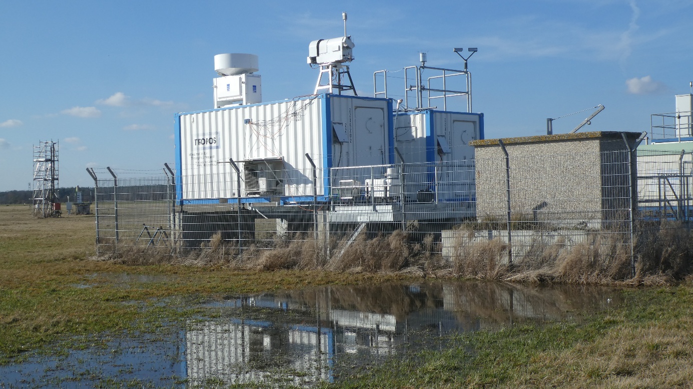
Fig. 1: On the radar container (left) the cloud radar MIRA-35 (rear) and a water vapor radiometer HATPRO (front) are installed. The wind lidar is placed on the platform in front of the radar container.
The “radar”- container houses the cloud remote sensing (CRS) instrumentation, i.e. the cloud radar MIRA-35 and a HATPRO G5 water vapor radiometer, both installed on the roof of the container. A HALO StreamLine XT Doppler lidar (“SHAUN”) is installed on the platform in front of the radar container (Fig. 1). A rain-gauge and a disdrometer are installed on the roof of the lidar container to record the amount of rainfall.
The station also includes a Lufft ceilometer CHM-15k, that is already operating at Melpitz since July 2020. The measurements of the boundary layer height are fed into the E-profile network of the German Weather Service (DWD).
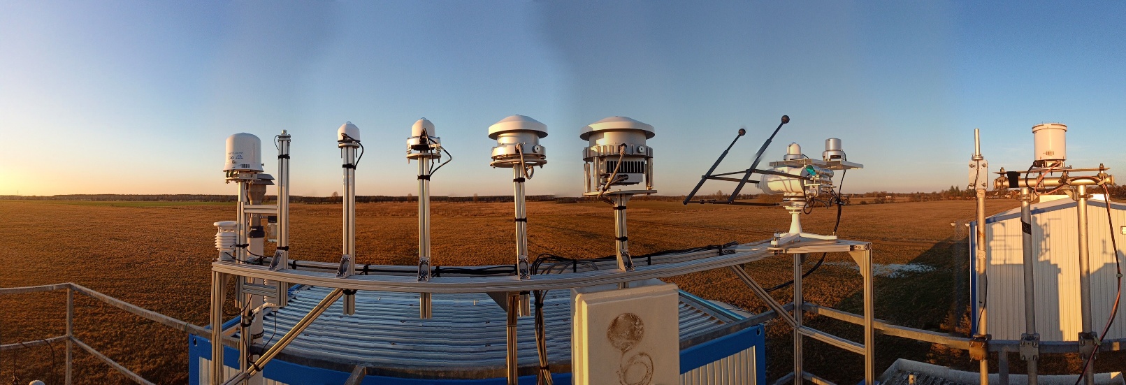 Fig. 2 The TROPOS-ACTRIS Radiation Observatory (TARO) is measuring the short and longwave energy budget, the spectral irradiance including UV and cloud fraction.
In addition, radiation measurement instruments are set up on another container roof. The TROPOS ACTRIS Radiation Observatory (TARO) combines secondary standard pyranometers, a pyrheliometer, and a pyrgeometer to observe the direct, diffuse, and global solar and terrestrial radiation. Two spectrometer systems are installed to measure the global spectral irradiance and UV-Index in cooperation with the Federal Office for Radiation Protection (Bundesamt für Strahlenschutz, BfS, Germany). Clouds are monitored using an all-sky imager.
Early this year, at the end of February 2026, a Saharan Dust event was already observed by the lidar at Melpitz. Particle depolarisation ratios in the lower Troposphere were as high as 25 % at 532 nm up to 4 km altitude. Fig. 3 shows the volume depolarisation ratio throughout the whole day. More details and hourly optical property profiles derived by the automated algorithm at TROPOS can be seen at polly.tropos.de.
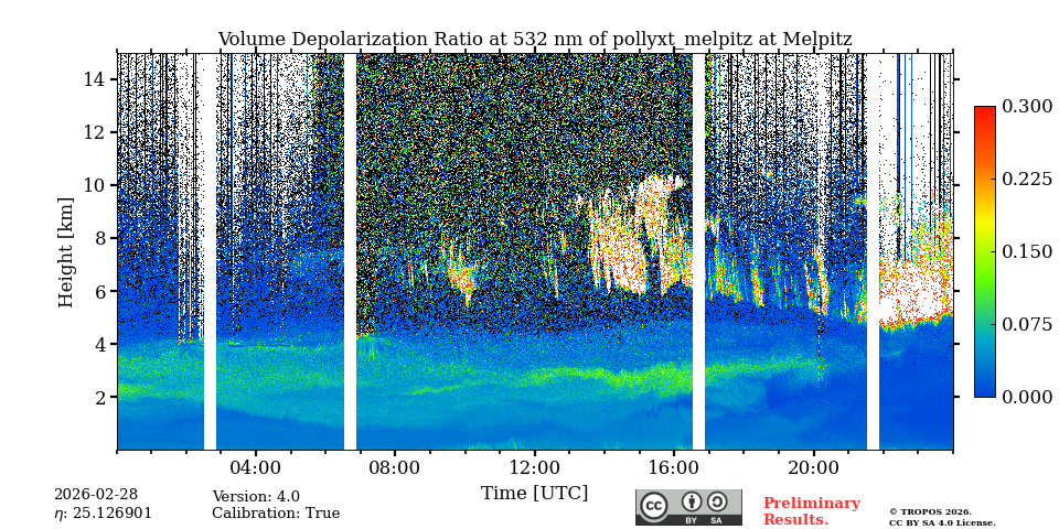
Fig. 3: Saharan dust was detected by high depolarisation values observed at the end of January 2026.
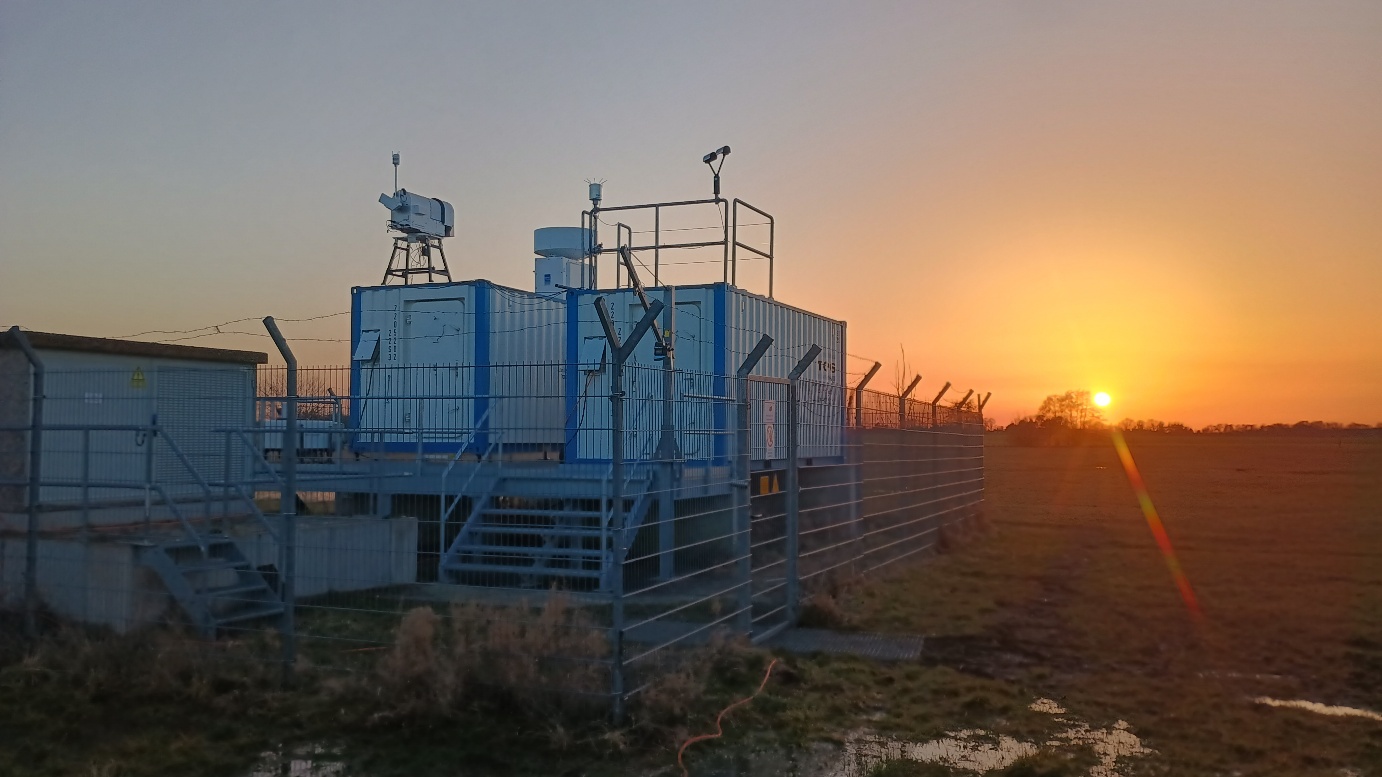 Fig. 4: Saharan dust was also visible by eye during the sunset on February 27, 2026. On the railing of the lidar container (to the right) the disdrometer and the rain-gauge are mounted.
On March 14, 2026 a cold front passed the Melpitz site with strong rain events throughout the day. The radar observations are depicted in Fig. 3. The different radar observations indicate different phases of the hydrometeors as well as their fall velocity. Also, the zero-degree level is visible just below 2 km height.
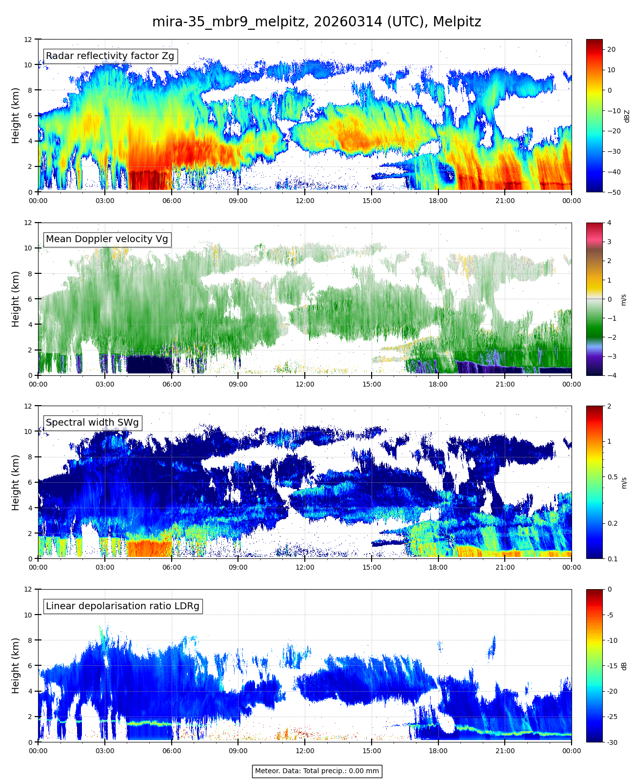 Fig. 5: Impressive clouds and rain events were detected by the cloud radar MIRA-35 on March 14, 2026.
Quick-looks of all measured data from the remote sensing instruments in Melpitz can be seen in near real-time at rsd2.tropos.de.